An EF0 also was confirmed to have touched down in rural Preble County as part of the same system.
It wasn’t just the tornadoes that caused problems in our region. Heavy, prolonged rain lead to record breaking rainfall at the Dayton International Airport on Saturday. The previous daily record rainfall at the airport was 1.26 inches set in 1949. A total of 1.52 inches fell during the 24 hours of Saturday.
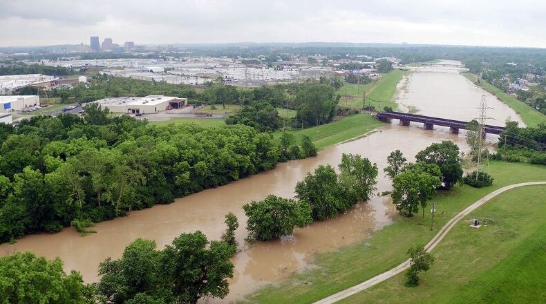
With the additional rain that occurred on Sunday and Monday along with rounds of rain and storms in the forecast for this week, the potential of flooding is increasing.
A flash flood watch remains in effect across the Miami Valley today with the threat of an additional two to three inches of rain possible. The already saturated ground and the increased amount of rain may cause a rapid rise in water levels.
Flooding is the second deadliest form of weather across the United States. In 2018, 80 people lost their lives due to being caught in flood waters. According to an article published in the Journal of Applied Meteorology and Climatology one of the highest flood fatality regions across the country includes the Ohio River Valley.
Heat is actually the deadliest form of weather in the U.S.
The best way to stay safe from flooding is knowing the difference between watches, warnings and advisories. Here is a breakdown of these weather alerts as defined by the National Weather Service.
Flood or a Flash Flood Watch means the potential exists for flooding to occur. It does not mean flooding will occur, but it's possible.
Flash Flood Warning is issued when a flash flood is imminent or occurring. If you are in a flood prone area, move to higher ground immediately. It is even possible to experience a flash flood in areas not immediately receiving rain.
Flood Warning is issued when flooding is imminent or already happening. You will typically see flood warnings issued in areas located along larger rivers, but can be placed in other areas too.
Flood Advisory is issued when flooding is expected, but not to be bad enough to issue a warning. However, it may cause significant inconvenience, and if caution is not exercised, it could lead to a situation that may be threatening to life and/or property.
You will likely see one or all of these issued in the coming days. Listen to WHIO-TV or 1290 and 95.7 WHIO for the latest information and updates. Be prepared to evacuate immediately if necessary and know your routes and destinations. Now is also the time to make sure your emergency kit is replenished with supplies, especially medications or other medical supplies.
One final thought, I know you’ve heard it before, but never drive through flooded streets. You may not be able to gauge how deep the water is until it’s too late. Just two feet of rushing water can carry away most vehicles including SUVs and pickup trucks.
About the Author
