The announcement comes ahead of the Tuesday expiration of coronavirus-related health orders.
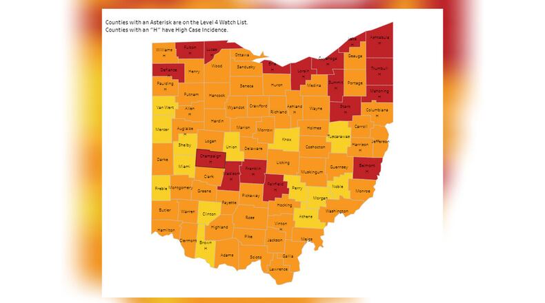
Gov. Mike DeWine unveiled the Ohio Public Health Advisory System in early July that featured four risk levels to represent the severity of COVID-19 spread in each of Ohio’s 88 counties. The risk levels were based on indicators such as new cases per capita, and sustained increases in new coronavirus cases, emergency room visits, outpatient visits and hospital admissions.
The last county map showing the incidence levels was published May 20.
“This map was very useful. It served its purpose at a different phase of the pandemic,” said Dr. Bruce Vanderhoff, ODH chief medical officer. “But now what’s most important, what’s giving us our best indicators of where we are, are our rates of vaccinations, our cases per 100,000.”
The current case rate is 82.3 per 100,000, and nearly half of Ohioans have had at least one dose of the vaccine.
Data analyst Jeff Brown from the state’s administrative service department said the advisory system is no longer useful because it was built as an early warning system designed to identify upward virus trends.
While the state will not be producing the weekly map, county and state health departments will continue to track case data.
In addition, the case and vaccine data will continue to be available on the state dashboards that are broken down by state, county and other attributes, such as age, gender and race, Brown said.
Although the health orders expire Tuesday, McCloud said there will be some protection left for extended care facilities that house the state’s most vulnerable residents. More information will come next week, she said.
About the Author

